Embark on a journey of geospatial and environmental analysis with the "Geospatial and Environmental Analysis" course. This comprehensive offering from the University of California, Davis provides a deep dive into the world of GIS, equipping you with the knowledge and practical skills necessary to excel in this field. Throughout the course, you will explore various aspects of geospatial analysis, including working with 3D data, raster manipulation, projections, and environmental variables. The engaging project-based approach ensures that you will gain hands-on experience, from project conception to analysis product delivery.
Throughout the four-week duration, you will delve into the following modules:
Upon successful completion, you will have mastered the creation of 3-dimensional surfaces, triangulated irregular networks, and the development and analysis of geospatial data. This course is an essential component of the Geographic Information Systems (GIS) Specialization, and it is recommended that you have equivalent experience to the preceding courses in the specialization.
Certificate Available ✔
Get Started / More Info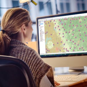
Explore geospatial and environmental analysis through four comprehensive modules. Gain practical skills, from utilizing common geospatial analysis tools to working with 3D data and projections. Enroll today to enhance your GIS knowledge and expertise.
Geospatial analysis takes center stage in this introductory module. You will gain a comprehensive understanding of the common geospatial analysis tools built into ArcGIS, as well as a working understanding of raster data models. This module also provides an overview of the project and the necessary data acquisition for the upcoming geospatial analysis project.
This module delves into the world of rasters and surfaces. You will explore topics such as raster data formats, display options, reprojecting rasters, and working with 3D data. Through practical assignments and extra practice, you will solidify your understanding of these crucial concepts.
Classifying and viewing data forms the core of this module. You will explore projections, coordinate systems, and environment variables, gaining a deep understanding of their role in preserving the properties of data. Practical tasks and discussions will enhance your learning experience.
In the final module, you will work through a comprehensive project, focusing on color ramps, binning/classifying data, and stretching rasters. The course concludes with a detailed project data analysis and wrap-up, providing a holistic understanding of geospatial and environmental analysis.
Embark on an extraordinary journey through the Biosphere 2 Science course to explore Earth and beyond, learning from leading researchers. Gain insights into climate...
Natural Attenuation of Groundwater Contaminants is a comprehensive course exploring the latest technologies and paradigms for implementing Monitored Natural Attenuation...
This course, Systèmes d’Information Géographique - Partie 1, offers a comprehensive introduction to geographic information systems. It covers spatial data digitization,...
Golf Course Management: Best Practices presents a comprehensive study of classic and contemporary golf course architecture, construction, turf and soil management,...